Services We Provide


During our experience using GIS, we have found that the system has served
to enhance the clients' understanding of a site's complexity. GIS also makes
possible the production of superior products. The use of GIS is highly efficient
for data mapping and analysis; maps that are visually interesting and clearly
understandable, which is key for both internal and external analysis and
presentation.
Geografika Consulting can provide the following GIS services:
- GIS Data Compilation
- Data Conversion / Digitizing
- Data Cleaning and Validation
- Custom Data Translation
- Model Building
- 3D Modelling
- Cartographic and Report Output
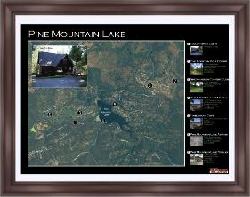
Geografika Consulting is focused on making beautiful maps.
Maps should clearly tell a story, and anyone should be able
to look at the graphics and decipher what they are trying to
say. We can create a fully customized map showing a
specific area and including items that uniquely important to
you.
Maps can include a high-resolution aerial photograph
depicting:
- Specific Neighborhood
- Vacation Property
- Family Farm or Vineyard
- University Campus
- Commercial Site
- Tourist Attraction
- Destination Wedding
Custom Cartography
| Geographic Information System (GIS) |
| Web and Application Development |
Whether it is internally accessible to project analysts and
managers, or externally available to a limited extent to the general
public, a well written Functional Requirements Document is this
document:
managers, or externally available to a limited extent to the general
public, a well written Functional Requirements Document is this
document:
- User Needs Assessment
- System Design
- Development
- Testing
- Implementation


